Monday, July 6, 2009

Day Fifteen: "Nothin' Could Be Finah than to be in Carolina in the Morning"

Tomorrow morning I fly home from Oklahoma City with wonderful memories from an intensive three weeks (12 states) on the road -- a wedding with family and great friends, a road trip without reservations, vistas and places covering 3,600+ miles (according to AAA) of country I've only seen in brochures, books, and movies.

Today we had a whirlwind of points of interest around the city. First, we had a quick visit with my new favorite artist/artisan White Antelope. She is holding one of her fancier dress pieces -- unfortunately, the display piece comes across too light in the picture...but the point of the picture is the wonderful spirit of White Antelope. She and her son suffered serious damages in the 1995 Murrah Building blast losing everything -- it has taken them years to rebuild their lives, home, and business.

As you can see by this wall, people are still leaving memorials on peripheral fencing in the former Murrah Building area. The memorial park to the victims features a large granite structure with 9:03 etched above the arch -- the time the bomb exploded. You can see a few of the chairs through the trees that honor each of the victims.

From there we visited the Oklahoma Museum of History -- probably one of the best (200interactive displays) museums I have experienced. Outside is a bronze statue of two young Apaches titled "Unconquered" by Alan Houser.


Inside the museum is a replica of Wiley Post's famous plane, Winnie Mae. Again, there is a light issue with my camera angle (and all the exterior windows). In the background, you can see the Oklahoma Capitol Building. This museum requires a much longer visit.


The last point of interest today was The Old Red Barn (1898) -- the only round wooden barn in OK -- located on Historic Route 66 in Arcadia, OK -- a short drive from Oklahoma City.
The barn is forty three feet tall and sixty feet in diameter (built of burr oak timbers). The clear spanned exposed timber framing of burr oak on the second floor is an incredible feat -- in fact, authorities say that if the builder had planned this structure on paper, he would have realized it could not be built.

Ernest "Butch" Breger, a local farm owner is the caretaker/attendant. This spry and very energetic 83-year old kept the barn open after hours to allow Jonette and me to browse the downstairs and then escorted us to the upstairs area along with two bikers who pulled up about the same time as we did. These two young men from Denmark (the Jutland area, they told me) are traveling the entire Historic Route 66 -- from Chicago to Los Angeles. One of these young men is an architect. They are researching many points along the route -- and this Red Barn, an architectural feat, is one of them. While we were upstairs, "Butch" wanted to show me how that area served as a dance floor. So, he and I two-stepped around the room with NO music while the two Dane dudes filmed. Can't imagine how this piece of Americana will play back home. :-)

This is the official end of my blogging for this trip. I already have a list of to-dos when I get home...and projects to accomplish in the next few weeks before school commences. What a ride we have had. Thanks, Jonette, for all the laughs along the way -- and for initiating this adventure.

Until the next time, safe travel mercies to all.

Rebecca

Sunday, July 5, 2009

Days Thirteen and Fourteen: "...where the wind comes sweeping down the plain..."

SATURDAY
The morning of July 4th found us in Amarillo, TX with plans to drive into Oklahoma City. West Texas was expansive and windy -- so, what's new? Well, perhaps the fields of wind turbines. These turbines were closer to the road than many we have seen along the way -- usually in the distance lining a high mesa -- and filling the fields as deep as we could see. No audible sounds to us in the car. I still do not understand the hoopla in opposition to these structures.

Closer to OKC we stopped at a "trading post" -- after all we were in Oklahoma by this time.There are treasures in these "trading posts" -- many items made by Native Americans. At this "post," a stately Indian stood guard at the entrance. Along with this Indian, outside there were impressive murals depicting the forced march, two painted buffaloes, and a real buffalo in a corral. Lots of local color -- literally and figuratively.


The bison is Oklahoma's state animal. Many communities over the world have "painted" objects to represent their areas -- cows (Chicago and Prague), doors, Palmetto trees (SC). Oklahoma decorated bison.

On the way into OKC, we stopped at Jonette's favorite Native American artisan's shop. White Antelope, the owner, and her son, Mario, make wonderful jewelry and art...as well as presenting the work of other Native Americans. The shop is a lttle art museum. White Antelope is an interesting woman wth spirit and humor. A few years ago Jonette had her make me a fetish-heishi necklace which I cherish.

When we finally settled into Jonette's home, the bottom fell out of the heavens with 60 mph winds, rain, and power outages all around us -- all fireworks canceled in the area. Throughout our road trip we NEVER encountered a rainstorm or severe weather. (We did have a little bit of a hailstorm going over the last mountain pass before Durango.) We have been SO fortunate in our travels! So, when the rains hit Saturday night --and we DID NOT lose power as 16,000+ others did in this vicinity -- we did not feel slighted for missing the up-close-and-personal fireworks. Instead, we settled in for the Capitol's celebration and the Boston Pops' traditional fare in HD. We slept soundly Saturday night finally "off the road."

SUNDAY
Neither of us awakened early today -- it actually was the first morning we both slept in. After a lovely brunch, we headed for the National Cowboy and Western Heritage Museum here in OKC. This sculpture stands at the entrance. This museum houses an incredible collection of art -- paintings, sculpture, exhibits of the early West, a re-creation of a circa 1900 Western cattle town and way of life. James Earle Fraser's magnificent and powerful sculpture "The End of the Trail" create s dramatic first impression (18 feet tall weighing over four tons) in the entrance. Sorry the lighting is poor for the picture -- if I took it from the other side, you could not see the face and other features.
The Native American exhibits depict several tribal worlds through design elements on clothing, tools, and utensils. Set in a lifelike 1950s area, the American Rodeo gallery showcases artifacts and memorabilia of history and champions. Another gallery features Western performers/actors, artwork, and more memorabilia from early Westerns (including the John Wayne Collection). There is much more here than can be seen in one visit!


Everyone recognizes this iconic statue by my favorite sculptor, Glenna Goodacre who also created the Sacajawea model for the one dollar coin; she makes Ronald Reagan almost look alive. Her work is remarkable. (Hopefully, you will have -- or have had -- the opportunity to see many of her originals at the Nedra Mattuchi Gallery in Santa Fe.)

We enjoyed our relaxed day.

Still working on flight plans home....

Friday, July 3, 2009

Day Twelve: Recalculating....

As most of you know, when we embarked on this adventure, we had ONE goal -- to experience the Crazy Horse Memorial in Custer, SD. Actually, we visited the memorial three times -- once for the better part of one day and twice for the night laser light shows (and mountain blast one of those nights). Additionally, we remained in the area long enough to visit Pine Ridge, Wounded Knee, the Badlands, the Black Hills, and Mount Rushmore -- savoring every minute. One day I hope to return for a longer visit -- and to see the progress on Crazy Horse.

Over the past few days we have wandered with some direction (but no reservations) through South Dakota, Montana, Wyoming, Utah, Colorado, New Mexico, and now Texas -- tomorrow we will reach Oklahoma City. In all, we have been in 12 states since we started in Missouri and traveled up through Kansas, Iowa, and Nebraska before reaching South Dakota. Along the way when we came to consensus about our next destination, I would plug in the town/city into my GPS (we have affectionately named "Olive"). If we veered from our intended route, "Olive" would speak out saying "recalculating, recalculating." She did a lot of "recalculating" as we changed our collective minds on a whim. Initially, we had ambitiously included the Grand Canyon, Sedona (AZ), Santa Fe, and Taos as potential stops BUT we "recalculated" in Grand Junction and decided to postpone those locations and head towards Durango and Mesa Verde instead..."recalculating" as we went. In school we must "monitor and adjust" -- recalculating constantly -- and that is a good thing.

This is the scene from our lodgings in Durango...mountains all around.

Today as we drove down from Durango through numerous reservations of the Navajos and the Apaches -- through expansive range lands without seeing a person or animal -- along highways with NO billboards -- under a huge sky, it was difficult to not feel pride in this country's beauty...which comes in many forms. From a mountain pass with snow-topped caps to red-rocked mesas to rolling hills to desert-like plains, I never cease to be amazed and awed. We have managed to be on few Interstates preferring the scenic byways.

For whatever reasons, we do not hear about the many areas involved in various types of energy production in this country...but my favorite has to be the lines of stately white wind turbines that suddenly appear on a horizon or on top of a mesa. I don't know why we don't have these in the SC yet. These turbines are HUGE but almost balletic in their movements. Very graceful. Elegant. This afternoon as we entered Texas, there was yet another field lined with these turbines and a rainbow falling right in the middle of them. Almost surreal. Couldn't find a pull-over soon enough to catch that on film.

Thanks to all of you who followed our travels. Sorry for the blog snafus along the way. I have never been able to figure out how to make the picture on the top right-hand side of the page stay with the appropriate day. Instead, it becomes permanent attaching to previous days. Oh, well...I'm still learning (and remember that this is my first attempt at blogging). And we never found that convertible to stage our "Thelma and Louise" photo shoot. Perhaps another trip. :-) Additionally, I have been gone from home almost three weeks -- I have so many things to do before school begins in a month. Where does the time go?

Reflections/Observations along the way:
1. I now have a greater understanding for the lyrics of "Home, Home on the Range." One part of the lyrics is "...and the skies are not cloudy all day." We drove through ranges after ranges seeing buffalo (not sure they were playing) and skies with NO CLOUDS. Think the part about "...where seldom is heard a discouraging word..." relates to the fact that there are FEW humans around from whom to hear such.
2. If driving the Beartooth Highway again, it would only be from Red Lodge, MT to Cooke City -- not the opposite direction.
3. If lodging in Yellowstone Park is a goal, phone ahead.
4. While driving through Yellowstone and you suddenly see a cluster of cars pulled off the road, you can be sure it relates to a wildlife event. Bring your camera AND your tripod for such photo opportunities. It is amazing how quickly folks could whip out those tripods!
5. Don't expect to see many cars or trucks along I-90...or gas stations or places to eat or anything except ranges.
6. We often wondered where everyone was as we traveled the scenic back roads and byways. I know. They were all at Yellowstone waiting for another Old Faithful show. You would not have believed how many cars and people appeared at this one site -- more of a concentration than we saw on the entire trip.
7. Jackson (the city) and Jackson Hole (the area) are definitely on my list to do again...for a longer time. Also, little towns in Montana and Wyoming, the hot springs in a number of places, and fly fishing in some of the many streams we passed.
8. The drive between the south entrance to Yellowstone and Jackson Hole is not to be missed. The snow-capped Tetons rise high and majestic.
9. Leaving the main roads can give pause for thought. We were fortunate that we had no mishaps traveling south through Montana, Wyoming, Colorado, Utah, and New Mexico.
10. There are still some very nice people out there. The two mechanics in Vernal, Utah who worked diligently to repair an over-heating problem on a 10-year old car (in a place that they said was a "truck town") were kind, helpful, gracious, and HONEST. They could have left us waiting for a part to arrive MAYBE in three days; instead, they jerry-rigged the problem to be handled at a later date. We never had another problem.
11. The scenic highways have few to NO billboards. How refreshing.
12. You can get great meals in some small towns...surprisingly good fare.
13. There are cars that get 30+ mpg -- I haven't had one in years -- and it is nice to not have to fill up so often.
14. I had forgotten the ferocity of the winds in west Texas. Years ago we traveled through this area and noticed the tumbleweed not tumbling but flying across the roads. Signs in front of businesses were on springs because the winds were so strong...otherwise, the signs would be bent or blown over. Today when we stopped for gas in west Texas, we almost had to hold onto the car to pump gas. Got my attention!
15. Our history books do an unacceptable job of portraying the plight of the Native Americans and the holocaust they have endured. There is much we could learn from their ways. There is much which this country owes them today.
16. Life is TOO short. There is so much to see and do. Don't wait.
17. This land is magnificent and grand -- and the sweeping vistas define descriptions. As I have previously stated, I'm all out of superlative adjectives. :-)
18. I loved our up-close-and-personal moments with the buffalo on the roadsides -- and all the other wildlife we encountered.
19. I marvel at the people who built the highways up and through some treacherous heights. And, I cannot fathom driving these roads on a regular basis.
20. While all Best Westerns are not created equal, they have exceptional complimentary breakfasts.
21. The back side of George Washington's head coming through the trees looks surreal when viewed from the road approaching the monument.
22. I had forgotten the 50+ shades of adobe used on structures around the Santa Fe area...even on the overpasses on the highway.
23. I-40 has entirely TOO many trucks on it.
24. The little town of Tucumcari on historic Route 66 is almost a ghost town. Someone needs to turn off the lights and forward the mail. Wonder how many other small towns along the route have succumbed in similar fashions?
25. Route 66 parallels I-40 for a long way. It looks so small and narrow but has transported millions over the years. What a storied past.
26. Fry bread should be eaten warm, not warmed up.
27. AAA has great TripTiks -- be sure they give you the old style -- better info and maps. Additionally, many motels offer 10-20% discounts on room rates with AAA membership.
28. A GPS is a good thing. It kept us straight and re-enforced turns and directions. Also, somehow or other, this little device can tell how fast you are going, what the speed limit is, where the nearest gas station is located, ATMs, lodging, etc. It is a handy-dandy gadget. We would never have found Bette's Kitchen on the Pine Ridge Reservation without it! There were NO signs advertising this place. The sign for Black Elk Road is almost obscured by bushes. If it weren't for the small picture on the flier AND the GPS, we would never have found it. Bette's niece said she misses the turnoff on occasion.
29. Before leaving on a trip, ask friends what they know or recommend about your destination. My neighbors provided a wealth of info for this trip and great suggestions -- and even maps.
30. We are fortunate and thankful to have had safe travelling mercies.

After a brief visit in OKC, I'll be flying home with many wonderful memories. I haven't been in Oklahoma since we left in the late 50s. We lived in Muskogee while Daddy was responsible for building a high energy fuel plant for rockets that would go into space. Think about Rocket Boys and October Sky and the race for space. It was a hush-hush project and we were the only Navy family in town. Never having been to Oklahoma City, I'm looking forward to seeing it.

Some day I hope you find a traveling companion and hit the roads without reservations. Never a dull moment...an adventure (and perhaps a surprise) around many curves in the road.

Safe travels to all!

Thursday, July 2, 2009

Day Eleven: Mesa Verde -- Clarifying History and Preserving the Works of Man


The reason for today's trip was prompted by a comment by my next-door neighbor, Jessie, who gave me many great ideas of places and things to see on our unplanned trek. Thanks, Jessie, for this one!

We spent ALL of today in Mesa Verde National Park (in southwestern Colorado near Cortez). This park consists of nearly 5,000 archeological sites including 600 cliff dwellings. Scores of large canyons seam the mesa -- and in the alcoves eroded in the cliffs are some of the world's largest and best preserved cliff dwellings. (Do you feel as though you are in history class? I was six hours short of a double major in English and history in college. I LOVE learning the stories behind events.) This park established in 1906 by President Theodore Roosevelt was the first national park of its kind. The park administers the preservation of archeological sites and other works and relics of the Ancestral Puebloan people. In 1978, Mesa Verde received international recognition as both a World Heritage Site and Biosphere Reserve. The Rangers told us that often there are more Europeans at the park than English-speaking people.

With over 53,000 acres, Mesa Verde preserves and protects over 4,500 archeological sites,including 600 cliff dwellings -- and over 3 million associated objects in the research collection. These sites are some of the most notable and best preserved in the United States.

The drive to the park from Durango (our current base) wound between and around high foothills to the peaks in the background.After driving all the switchbacks over three mountains recently, this was relaxing. Coming around a curve, Mesa Verde was unmistakable. Now this is a major mesa. In fact, there are two primary mesas associated with this National Park.

From the park's entrance (where we once again were able to "flash" our Senior Lifetime Pass to all National Parks -- that's ALL we're flashing these days!), we climbed 15 miles to the Visitor's Center. As I've stated previously, there are just no more superlatives to describe the vistas we see around every turn. YOU must come and see them one day!

Fortuitously, we were able to join a half-day bus trip with a park ranger. (This was a helpful thing since my friend is unable to walk any distance.) This was also a good decision because the ranger was informative, entertaining, and allowed us to see more than we would have on our own. (My neighbor had suggested that this was the best way to see the park initially.)

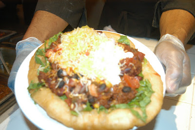
But first, we had lunch -- Navajo tacos. Ever heard of these? My friend has been talking about Indian tacos since we started our travels -- evidently, this is a "hot" seller in OKC. When we were in the Black Hills (SD), there were a few places offering Indian tacos. In all my culinary experiences in places around the globe, this was a new treat. Here are the differences in Indian tacos and the tacos we primarily know. First, fry bread instead of tortillas forms the basis of this dish. The fry bread is flat and the size of a plate! (If you don't know fry bread, watch one of my favorite Sherman Alexie movies called Smoke Signals -- they refer to this delicacy frequently.) Then a variety of toppings are artistically placed on the fry bread...chili or chicken, beans, shredded lettuce, cheese, onions, and the best jalapeno spread that looks for all the world like guacamole. There is no way one person could -- or should -- eat this entire creation. I meant to take a picture of my dish but remembered this task halfway through (when I stopped eating) so I went back to the kitchen and they let me photograph one they had just fixed. Unfortunately, the light was not good or the camera or the person tilting the plate moved so the picture is somewhat blurred...but you can get the idea. It was double yummo.

Okay, here is your history info for the day. The earliest known inhabitants of Mesa Verde were the Modified Basket Makers, descendants of a people who lived in the Four corners region. They built subterranean pit houses about A.D. 500 - 750. From A.D. 750-1100, these cliff dwellers perfected their living quarters, building kivas (ceremonial or domestic rooms -- depending with whom you speak) and masonry houses around open courts (pueblos). From A.D. 1100 - 1300, arts and crafts reached their peak; pottery and cloth were often elaborately decorated. Around 1200, these people moved into the alcoves for reasons that remain unknown and built cliff dwellings. Sometime about 1276 a drought struck and lasted 24 years. The resulting crop failures, depletion of resources, other environmental problems, and possible conflicts may have driven the people from Mesa Verde in search of a more reliable water supply and improved living conditions.

Some of the Pueblo people living in the Rio Grande pueblos in northwestern New Mexico and on the Hopi mesas in Northern Arizona are descendants of the former occupants of Mesa Verde. After ALL the painstaking work, the people who built these cliff dwellings only lived in them for 100 years. That would entail two to three generations since women averaged a life span of 24 years and men often made it to 40 years. These people were little with men standing 5'4" and the women only 5' in height.

From our history books, I always had the impression that these cliff dwellers lived in these dwellings for thousands of years. Not true. Only the last 100 years (they lived in his area!) as previously stated. Their pit houses gave rise in later years to a series of better housing. We were fortunate to visit several of these sights up close and personal.

Looking across the canyon with Ranger Tim as our guide, you can see the Cliff Palace, one of the most photographed of the cliff dwelling. (When we got on the bus, we didn't realize that we would also get to go into the Cliff Palace.) Reaching the actual site of the Cliff Palace involves descending uneven stone steps and climbing five ladders for a 100 ft (30M) vertical climb. I know that these don't even appear real but this is the actual Cliff Palace exterior. According to Ranger Tim, there were 21 families living here "condo" style -- each family built their home in their own style...and you can see this up close. Additionally, this complex consisting of over 150 rooms extends 90 feet into this rock area. It was difficult to get my head around the kind of hardships these folks faced. They were farmers primarily after their basket period planting corn, beans, and squash together -- the Indians call these vegetables the "three sisters." Did you know that they planted the corn the beans, and the squash in the same hole? The corn provided a stalk for the beans and the squash provided shade to hold in the moisture around the plants. Very clever.

We also got to see Spruce Tree House, the best preserved of the cliff dwellings.

We left this area enriched and educated.

Ah, so it was getting towards supper time by the time we left the park. Yesterday while we were cruisin' the Main Street of Durango, we passed Jean-Pierre's French (of course!) Bakery and Restaurant. Decided that would be our final stop for the day. We were not disappointed. Again, it was a lovely restaurant wth an eclectic but elegant feel. The food matched the ambiance.I had French Onion Soup and Escargot (not exactly a balanced diet but very tasty -- and not as delectable as my favorite little French bistro Le Bonne Soupe in NYC) and my friend had trout flown in from Pike's Market in Seattle. (Wonder why they didn't have locals supplying the fish?) Great service and food. Highly recommend when you are in town. :-)

I'm hoping that we will be heading towards OKC tomorrow. This has been a fun trip but all good things must come to an end. Probably will do ONE or TWO more blog entries...just depends. Thanks for hangin' in there with us on our Crazy Horse and more adventures.

Wednesday, July 1, 2009

Day Ten: Rocky Mountain Highs -- and "Hi" to all from Durango, CO

First, I'm sorry I did not get pictures of the incredible mesas in Mesa County where Grand Junction is located. When we rolled into town last night, the shadows were long and the traffic on I-80 truckin' fast. (You'll just have to experience them yourselves first hand one day! Spectacular and mystical.) This morning we set the car on a southward course away from the majestic mesas -- and for a couple of hours we watched as the looming snow-capped Rockies became closer. After Montrose, we began to climb. The scenic town of Ouray (pronounced "you-ray") tempted us to stop for a few days. Son James had told me about the hot springs there -- and we passed it full of people enjoying the "waters." A quaint and fun little hamlet.

Before the first sliver strike in 1875, the Ute Indians came to the area to enjoy the hot springs. Ouray is the halfway point along the San Juan Skyway, Colorado's first scenic byway. Since the San Juan Mountains are geologically younger than other Colorado ranges, the San Juans present a more jagged, precipitous appearance. The town also marks the northern terminus of the byway known as the Million Dollar Highway, which is cut from nearly vertical cliffs ...with STEEP drop-offs and NO guardrails. Proceed with caution!.


From there we began climbing quickly up the first of three 11,000 foot mountains.

Around EVERY sharp switchback was yet another breathtaking view. After awhile it was hard to decide just what we "needed" to memorialize -- too many opportunities -- never a bad view.
I loved the Aspen trees we found high on the mountains -- and with rain threatening and the wind blowing, the leaves danced (helping distract me from the next hairpin switchback -- I wasn't driving).
Wonder if the folks who drive these mountains ever tire of these views?


The last climb was over the Red Mountains -- appropriately named as you can see from the picture. I was a happy camper to see the bottom of this last mountain and the valley of Durango!

Durango began as a railroad town with Victorian vestiges of the past accenting the downtown area. What a fun town -- this is another place to which I'd love to return. And it's a happening place.

Coming down the mountain with all the switchbacks were legions of mountain bikers. We even saw a dozen or so going over the mountains...move over Lance Armstrong. There are all kinds of typical mountain recreational activities, great shopping, cultural events, whitewater rafting, and nice folks. Durango with a population of 17,000 has farmers, ranchers, herbalists, artisans, entertainers, a college, and great cuisine.

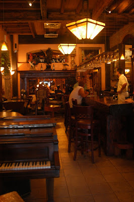
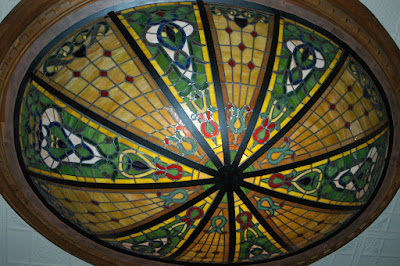
Tonight after a recommendation from several locals, we opted for a "nice" supper since many of our recent meals have been "on the fly." If YOU are ever in Durango, the Mahogany Grille on Main Street is my recommendation -- and it will be a treat. Besides waiters who are well trained and a complimentary "Mahogany Cheer" libation, the ambiance adds to the experience. See the beautiful lighting on the ceiling?


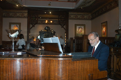
We really enjoyed the pianist who played throughout our meal. I had the BEST appetizer that would have suited me as dessert: Caramelized Mission Figs with Chardonnay Honey Reduction served with Panko Encrusted Brie and Pear/Apple Slices/Toasted Almond Slivers and Toast Slices. Oh, yum. The main course was Chilean Sea Bass. (Just to set the record straight, there is no such thing as Chilean Sea Bass; that is just the name used in restaurants -- the official name is Patagonian Toothfish...but who would order that?). Double yum. Great decor.

We walked down the street after this sumptuous repast, window shopped -- I love this Storyteller Doll in the window, checked on the Durango-Silverton schedules, and settled back in the room. The pubs and entertainment places were gearing up -- lively sounds wafting into the streets. This town is set for the Fourth of July festivities.
Not sure just where we will be on that date.

And, I have officially run out of superlative adjectives to describe the landscape. My lexicon is depleted. :-)

Tuesday, June 30, 2009

Day Nine: Open Range -- Loose Stock

We saw these two folks when we checked into the motel last night in Pinedale, WY -- and then again this morning at breakfast. They are in their 70s and are "cruising" for a month. Love their spirit. Long-time friends from Missouri and Arkansas, they are traveling the areas south of the Canadian border throughout the West with no particular plans past the next day of traveling. (We can relate!) After graciously posing for this picture ("all geared up" as they said), their delight riding out was palpable. Yea for them!

Okay, we made some executive decisions today subject to change. We were heading towards the Grand Canyon, Santa Fe, and Taos before going to Oklahoma; however, because of a number of reasons, we are going to Cortez, CO to see the Cliff Dwellers at Mesa Verde and to Durango with the intent of riding the train that runs between Durango and Silverton. (It is the one featured in the movie Butch Cassidy and the Sundance Kid with Robert Redford and Paul Newman.) At least that was our intent this morning -- and it is again tonight...but it wasn't this afternoon. Our plans continue to be flexible and subject to change....

Driving out of Pinedale we saw llama ranches, herds of elk, a few buffalo, many oil wells, natural gas wells, cows, and the exquisite Wind River Mountains (almost a rival for the Tetons) that followed us far down the valley. (My next-door neighbors in Columbia love these mountains having spent a few years in this area.) We never fail to marvel at the landscape -- even after miles and miles. We will go over a ridge and it will appear that we are suddenly transported to another world. Quick changes. Along this road in central Wyoming there are sporadic groupings of trailers for oil and gas workers. This area appears to be going through a "boom" -- the government leases the land to farmers but retains the mineral rights. Rich idea.
When we reached the proverbial fork in the road today, we went straight! Straight through interior Wyoming, a section of Utah (no joke!), and south towards Durango. We have ridden the tops of plateaus feeling as though we could almost touch the sky. Along the roads are posted many signs stating "Open Range -- Loose Stock." Frankly, we saw little loose stock on the open range (except us). We rather felt like loose stock on the open range. :-) Perhaps our ambitious decision to trek into these hinter lands was not the smartest route since we rode miles and miles with no signs of civilization -- but it turned out to be a fortuitous one. Here's why....

After crossing Flaming Gorge Dam and Reservoir in Utah -- incredibly beautiful high in the mountains in the middle of NOWHERE and part of the Colorado River Project (so the sign read) -- our car began to overheat. At that very moment the first gas station and the first signs of human beings in the past couple of hours suddenly appeared in front of us. Wow. After allowing the car to cool down and adding a little coolant (just one of the multitudinous supplies my traveling companion stocked in her car), we proceeded up the mountain again. Heading down the other side of the mountain with nine advertised switchbacks, the car again began to over heat. And, YES, we were driving with our gears and not the brakes -- with the air conditioning off. So, there we were on a pull-off area with the hood opened to allow some cooling. Using "Olive" (the trusty GPS intimately involved in this trip) to look for the nearest garage or transmission facility, the first business name that popped on the screen was Christensen Transmission Services in Vernal, Utah, the first town in the valley at the bottom of this mountain. Less than a minute later while we were discussing which potential number to call in Vernal, we heard a car pull up behind us. Here we sat -- two women alone in a crippled car -- listening to the measured crunching of the gravel as we knew someone was approaching our car. As I took a deep breath and turned to face whomever was just inches away, I did a double take. The guy standing to my left was wearing a Christensen Transmission Services work shirt. SERIOUSLY. We were almost freaked out (as the kids say). This nice young man checked out the situation and said that if we wanted, he would either tow the car in or we could drive to his place of business and he would follow us down the mountain to be sure we were all right. We could not believe it. Looking at the GPS with this name and suddenly the guy appeares? He was...like an angel to us!!! (It was either "The Twilight Zone" or "Touched by an Angel" time.)

The short version of the rest of this story is that Cody (our new angel -- definitely!) and his boss (whose family came from South Carolina three generations ago) worked on the car for three hours and fixed the problem. We were considering our options and the fact that we may be stuck in Vernal, Utah for a few days waiting for a part to arrive -- remember, we were near nothing out here in Utah! We had just about decided to abort the remaining trip and head home towards Oklahoma City (which would have suited me at this point not trusting the car...but we still had MILES to go). In the end, these two mechanics charged less than one hundred dollars and crafted a temporary fix to the problem. Incredible. The nicest folks -- should have taken a picture of them. The young girl who worked in their office told us she had never been out of that valley -- and we could believe that! This is the area in which many dinosaurs have been found. There is a town just down the road named Dinosaur and the Dinosaur National Park is here...so, perhaps some of you may have been in this area before?

Our revised route took us around Douglas Pass through beautiful valleys criss-crossing pristine streams. Again, much drilling going on in this area! Eventually, we made it to I-70, a very welcomed relief after all our twists and turns, with the final destination for today being Grand Junction, CO. The drive through the walls of red-rocked striated formations followed the Colorado River. Coming out of that canyon through a tunnel, we emerged facing the majestic mesas of Mesa County. These are ohmygosh incredible...one after another on both sides of the road for as far as the eye can see. This brought us into Grand Junction. After a quick trip to Taco Bell, we are ready for a good night's sleep...and thankful for safe travels and kind folks along the way. Phew!

----------------------------------------

P. S. Today I received a comment from a person in Bozeman who read my blog and corrected my comments about the name change in Jackson. Our source for that initial info was a person in a convenience store where we stopped for fuel in Jackson (probably not the town historian). Jim MacDonald offers the following clarifications:

"One point of information, Jackson didn't change its name from Jackson Hole. The town has always been named Jackson. Jackson Hole refers to the entire valley that stretches from the town north toward Yellowstone. It's the valley, and the Tetons are the mountains that rise suddenly from the valley called Jackson Hole. It was named after a member of the Rocky Mountain Fur Company, and the "hole" basically refers to the areas where trappers trapped ... a particular trapper's area was his hole.

Of course, to make the town distinct from the many other places called Jackson, it helps to market the whole town as Jackson Hole, and that's why you see it on all the t-shirts. Generally, locals call the town Jackson, and tourists call it Jackson Hole."


We learn something every day. Thanks, Jim.

Day Eight: When you get to a fork in the road, take it.

This day began in Gardiner, MT just outside the north gate of Yellowstone Park (near the Hot Springs). The view from our motel was glorious with the snow capped mountain looming across the valley. As we entered the park, we again saw the HERD of elk just hanging out on the median near the entrance, under trees, all around a cabin, and in the front yard of the medical clinic. They were oblivious to the cars and people. Quite serene.

Our primary goal today was to see Old Faithful since I'm the only one I know who hasn't seen it -- and it did not disappoint. After not seeing many cars on the roads all week, I now know where they all were...at Yellowstone waiting for the Old Faithful show. For this one show, there were people rows deep in a semi-circle to see the "blow." The Ranger said that our show was predicted to go off at 2:47 pm --and he was really close. Prior to "the show," several smaller geyser around the back area teased the crowd with little geysers before Old Faithful did his thing. Son Clayton worked at Yellowstone one summer and loved it. I understand why. Know he was in his element with the fly fishing -- there were fisherman in streams throughout the park. Wanted to jump out and join them. (One of my favorite days of all time was spent with Clayton standing in a trout stream south of Fairplay, CO fly fishing -- during Clayton's four-year sojourn in Breckenridge. Ready to go again!) The views belonged on calender pages....

They are doing road construction work on many sections of the park -- new lodge and inn, upgrades of informational facilities, and roadwork. Lots of roadwork. (For those of you traveling in this area any time soon, there are numerous work delays towards the south entrance to the park. Check with the rangers for updates.) Since we had no definite schedule we decided to head south towards Jackson and the Tetons; we meandered our way towards the south entrance of the park -- and we weren't disappointed. The drive from Yellowstone to Jackson (formerly known as Jackson Hole -- changed the name a couple of years ago...who knew?) was worth the trip. We felt compelled to stop at every "turn out" or "pull out" to take yet another picture and gaze at the majesty of these mountains. (I don't know, Lang, but this drive is almost up there with the Beartooth Scenic Highway.) This truly looks like the Alps.

Okay, I've found another potential home. Jackson, Wyoming. (Somehow it sounds incomplete -- liked Jackson Hole better. The airport is still called Jackson Hole.) What a fun town!! Son James told me to check out the Silver Dollar Bar for Harrison and Calista. :-) I can see the draw for the area. Fun shopping opportunities, restaurants, and lots of local color. The little main square has a huge antler arch. Such atmosphere here.

Since my traveling companion is limited in her walking ability (and not crazy about bars and pubs), we continued south to Pinedale, a small community that is becoming a boom town because of what is under the ground. The Wind River Mountains were to our left all along this drive -- spectacular range. There are few businesses in this town with a population of 1,200. (The "roughnecks" come in on the weekend from the oil and gas fields, so we were told -- a "wild west" experience.) Still, we had our choice of five brand new motels. Having spent several nights at Best Westerns on this trip (with good breakfasts included), we chose this again. We are miles from anywhere but that is fine -- on another adventure tomorrow.

Have to tell you about two guys who pulled up on "bikes" as we were unloading for this evening. We are used to bikers since they are out in legions this summer. These two fellows had gorgeous Harleys and fine leather saddle bags. When they pulled off their helmets, we saw two older gentlemen with white hair (hey, they had hair) just full of life excited about their day's ride. Wish I had taken their picture -- if we see them in the morning, I'll ask them to "pose." Can just imagine the fun they are having.

In talking today, we decided to re-think the previous plans of going to see the Grand Canyon and Santa Fe/Taos (having done this before) and take the fork in the road -- to visit Mesa Verde in Cortez, CO and Durango before turning east towards Oklahoma City. More on that tomorrow.

Sunday, June 28, 2009

Days Six and Seven: Greetings from Yellowstone National Park (and we finally know why the bear went over the mountain)

Before beginning, I have some quick comments: Thanks again to Kristin for her assistance (and I can use all I can get!) with some blog glitches. Also, we lovingly named the hand-held GPS we are using on this trip "Olive" -- and there are a few of you who will appreciate that. :-) The reception for cell phones and air cards has been sketchy at best preventing any blogging. So, I'll do my best to recall these past two days. Pictures may have to be added later. Something keeps closing my work. AND, I'm running out of superlative adjectives to describe the sweeping vistas and mountains. Help!

Saturday morning we said goodbye to Custer, SD and the Black Hills area (regretfully) setting out for our next must-see, Devils Tower in Wyoming. But first we had to check out Deadwood -- famous for all the outlaws who hung out there -- and Spearfish before trekking off I-90 for miles and miles and miles northward in the middle of nowhere.


Our first glimpse of Devils Tower was from many miles away -- somewhat surreal in the distant landscape. Imagine our surprise when we arrived at the National Park and found dozens of folks already walking around this monument. (Note: For any of you so inclined and who are of the "senior" status, we can buy a Senior Pass for $10 good for a LIFE TIME (!!!) of admittances to National Parks. Cool, huh?)

But I digress...for those of you "young" enough to remember Spielberg's Close Encounter of the Third Kind, you will appreciate this monument -- actually the very first National Monument...thanks to Teddy Roosevelt. Yep, it looks just like the movie. Kept waiting to hear the do-do-do-do-do-do-do refrain. (There were DVDs of this movie for sale in the local stores outside the park.) Visitors to this park can hike around the monument (about a 45-minute walk) or hike many of the well-marked trails. The Native Americans still consider this monument sacred and congregate in June yearly for ceremonies. During June, climbers are asked to not climb the rock in deference to the ceremonies. Near the entrance of the park are more prairie dogs than I have ever seen. Probably thousands in little burrows. I just imagined the pleasure that the pioneer children might have felt first spotting these little creatures while on their seemingly endless journeys through this area.

After back-tracking to I-90, we headed west not sure of our destination that day. The terrain and landscape were constant amazements. We would go from rock formations to desert-like mounds to rolling lush hills to plains to basins. Check out a map. Additionally, we have seen the most beautiful horses everywhere along the trip. Today there were herds of these exquisite creatures on most vistas -- many looked like horses for the Indians.

I have a new appreciation for the long-haulers who travel this route along I-90 having seen winter scenes on television. Miles and miles of miles and miles always on the look-out for wildlife...particularly the ones adjacent to the roadways. Suddenly, we saw snow-covered mountains looming large and thought it a little late in the day to continue on. We got through that first set of mountains (The Big Horns) but decided to call it a day in Sheridan, Wyo. The Best Westerns upon which we have chanced have wonderful breakfasts -- highly recommend them on your travels.

Except for the ubiquitous bikers who are EVERYWHERE in this area, Sheridan was a quiet place. We missed Buffalo Bill Days (they concluded a few hours before we arrived) complete with re-enactments of the pony express riders' abilities and sharp shooting.

This morning we arose with Red Lodge, MT as the potential goal. My next-door neighbors, Jessie and Lang, lived in Lander, WY but traveled these two states extensively -- think they would return tomorrow if they could figure out the details. Lang insisted that the drive between Red Lodge and Cooke City on the Beartooth Scenic Highway should not be missed. Charles Kuralt called this the most beautiful highway in the "Lower 48" -- hey, how could we miss it?

However, to get to this location we first had to cross The Big Horn Mountains. Wow, oh wow. What a route. While we were in low gear for much of the trip, the experience and sights were amazing. Someone has placed markers on the layers of rocks in The Big Horns stating the geological periods and ages. Some of the signs read that the rocks are 2.5 billions years old...some ONLY 20 millions years of age.

Coming out of The Big Horns we passed through so many changes of terrain that went on and on and on -- sometimes with NO signs of life (human or otherwise). Grim but fascinating.

Oh, true story. Not far from Red Lodge, MT is a small town named Belfrey. We passed in front of the school and saw the sign stating "Belfrey High School -- Home of the Bats" -- oh, please!! Can you believe that? Why would "they" do this to kids? Can't you imagine the kinds of taunts they must receive in competitions? Poor babies. "Hi, I'm a Bat from Belfrey." Oh, dear.

Just up the mountain from here is Red Lodge, a ski resort catering to the Billings, MT crowd. Quaint and friendly. A local recommended the Bridgecreek Kitchen and Wine Bar -- great local color and excellent cuisine. After a leisurely lunch, we headed towards the Bluetooth Scenic Highway, a 55-mile stretch across what at times feels like the Swiss Alps, the Grand Canyon, and a moonscape (way above the tree line).

Along the way are several pullouts -- we might call them overlooks -- for viewing and picture-taking. There were many switchbacks, stretches of steep grades, and way too many hairpin turns with no guardrails (on the ascension from Red Lodge -- coming down into Cooke City is a much easier ride). I have to admit two things: it was as beautiful as Lang promised and much more than an "E" ticket ride at Disney World (you have to be of a "certain age" to remember that as well). As soon as these Internet connections permit, I'll put up these pictures as well. For those of you burning up at home, let me say that we saw glaciers and remnants of a recent snow fall while on this scenic highway.

One of the Forest Service employees (a delightful young lady from outside Knoxville, TN who told her father that she has found a new home in these mountains) told me that it snows at least once a month during the summer. During the winter they get 300 feet of snow as a rule. The owner of "Top of the World" -- a little grocery/goods store near the top of this range -- confirmed this fact. We had to get out of the car and make a snowball to prove this point to ourselves. The glaciers gleamed against and between the rocks and trees spilling over many vistas.

Well, when we got to Cooke City (relieved and exhilarated), my traveling companion deemed the little town TOO rustic so we proceeded to Silver Gate. Still too rustic. Hey, folks. We are in the mountains, right? Anyway, the next stop was the northeast entrance of Yellowstone National Park. The Rangers at the gate -- after showing them our "Senior-Good-for-Life" passes and telling us there was no room at the inn or ANY place in the park for the night -- proceeded to quiz us on our governor's current situation. They did give us a suggestion to try Gardiner, just outside the north entrance to the park.

So, we proceeded to meander through the park. This concentration of visible wildlife in the Lamar Valley (aka Valley of Eden) afforded sights including herds of buffalo (but we have already had our up-close-and-personal times with buffalo on the road!), a group of elks, cougars, a grizzly eating a dead buffalo, a baby bear up a tree, the business end of a HUGE elk with a massive rack, and a brown bear meandering along the road. After all, it was supper time and the animals were everywhere particularly in the Lamar Valley. (We actually saw no wildlife driving from the Old Faithful area to the south entrance -- except for the occasional chipmunks scurrying across the road.)

After one last attempt to see if there might be a vacancy at the Mammoth Hot Springs Lodge at the north entrance (to no avail), we headed back out of the park down the mountain to Gardiner. Found a very nice room in the second place we asked and collapsed. What a day! What a day....

Friday, June 26, 2009

Day Five: The Indians didn't win this time

We left this morning intent on visiting Wounded Knee and the Pine Ridge Reservation. I was not clear initially what the push was to go to the reservation -- it is not a tourist destination as we discovered -- but I learned along the way.

We drove through three National Parks today. The first one is in the Black Hills -- Wind Cave National Park where after seeing a sign that said "Do not approach buffalo" we came over a rise and encountered herds of buffalo grazing across an incredible vista of rolling green hills and big sky. Think Dances with Wolves meets Little House on the Prairie. And now the age-old question has been answered for me: "Why did the buffalo cross the road?" Simple. To get to the other side, of course. Some of the buffalo grazing next to the road would suddenly decide to cross the road to where the rest of the herd was...meandering across with no concern for vehicles. Of course, we were going slowly but still! This mother buffalo had twins! (Everywhere we have gone, fields have been full of babies -- horses, cattle, goats, sheep...and even buffalo.)

This "big fellow" and many of his buddies were grazing just feet from the road. No problem staying in the car to take photos! Guess I wasn't expecting to see so many herds of buffalo -- although all the markets in the little towns through which we pass advertise Grade A Dakota Buffalo meat for sale and it is on all the menus. Very lean meat.

I did feel as though we were in a movie with these huge animals roaming about. The other thing that struck me -- having seen too many Westerns as a child -- is that I half expected to see lines of warriors appearing suddenly along any given ridge as we drove. This is a beautiful expansive area.


After a brief stop at the Red Cloud Indian School to view their art exhibit (which we saw advertised on a sign), we proceeded towards Wounded Knee on the Pine Ridge Reservations. The roads had little traffic -- the Indians have few cars. While these Lakotas have hundreds of thousands of acres, they have no source for income. More on that in a minute. Well, the road signs saying how to get to Wounded Knee are adequate; however, when we actually got to the site, there was not one marker anywhere to say that this is Wounded Knee. Nothing. The picture here shows the entrance road to the site coming off the main road. Unmarked. Rutted. Do YOU see a sign? A few hundred feet up an incline is a small rarely used vestige of a Catholic church (that has nothing to do with Wounded Knee) and a graveyard primarily for the four major families in this tribe -- and a single marker honoring a number of chiefs. Three young high school students poorly dressed (one with her baby) were standing at the entrance of the cemetery waiting for a cousin to come with some handmade items they might sell to an infrequent visitor who happened to wander in (such as we were). They said that they had no transportation and nothing to do on the "rez." They have no cars or money. No buses run through this area. There are NO towns close by. We were WAY OUT in the middle of nowhere. They have no prospects for their futures unless they leave the "rez." I asked about the events of Wounded Knee and they replied, "Oh, you mean the massacre?" One pointed out the area just a few feet down the hill by the stream. He didn't say anything else. We drove through the "rez" (south to north) and saw nothing but abject poverty. Very, very sad living conditions (if you can call that living).

We did have another interesting encounter on the "rez." While at the Red Cloud Indian School, we noticed a flier for a restaurant called Bette's Kitchen. I asked one of the workers at the exhibit about it and she said, "Oh, yes. That is REALLY good." She gave us the impression that Bette's Kitchen was THE place to go...so we went. Hmmm. Another sign issue. We were told that there would be many signs along the way. Zilch. Now remember, we are way out on the "rez" -- with a general idea of the location. Finally, with the assistance of the GPS we saw Black Elk Road and the sign for Bette's Kitchen. Double hmmm. Straight up a severely rutted incline in the distance was a structure that vaguely resembled the picture on the flier...so, we continued upward somewhat warily. This was NOT a restaurant but someone's dilapidated double wide with broken down cars and machine parts in the yard. There was a sign that said "Yes, we are open" so we proceeded forward on this "adventure." A mangy dog loped lazily towards us offering wet welcomes as we ascended the steps into the trailer. Sure enough. This is Bette's home and you eat in her kitchen. We entered through the laundry room and sat at her dinette and had a cup of chicken and rice soup in a Styrofoam cup along with a piece of fry bread and a bottle of water. The soup was actually quite good -- the fry bread had been made a few hours early (obviously). Bette and her niece were very gracious but it felt like we were intruding. However, they did say that they had 75 people on a tour bus the day before -- I have NO idea how a bus made it up that hill or why they would bring a tour to this trailer. Still, I have to give it to these two women; at least they were being a little entrepreneurial in this abyss of poverty. On the walls of this home were dozens of pictures -- of chiefs in ceremonial dress, lttle girls in tutus at recitals, school pics, young men and women in uniform who had served in the Armed Forces, and many family shots. The most outstanding thing about this trailer kitchen/restaurant (besides the fact that it is the only game in town) is the view. Oh my gosh. Spectacular vistas of rock buttes that line one side of this valley for as far as you can see. As we made our way gingerly down the rutted hill, we both were more than a little depressed for these proud people and their plight in life thanks to our government.

The drive through the Pine Ridge Reservation led us to the Badlands National Park. We went from rolling lush green hills to a moon landscape with mounds and pillars and mesas and rims of what appears to be white sand structuress. We drove through the middle just marveling at the unique formations. Some of it looks like the Grand Canyon. Then suddenly we were back to the lush rolling farm lands as we exited the park. Rather felt for the two manned U. S. Park Ranger Stations at each end of the park. They are stuck in the middle of all of this with no stores, no cell phone service, and precious little traffic with whom they might talk. I can see why it is called the "badlands."

As soon as we left this area, we began to see signs of civilization again -- and the greening of the landscape. We weren't too far from Rapid City. On the homeward bound leg of this day's journey, we decided to take an alternate route back to Custer -- through the Custer State Park. That was definitely a great decision and perhaps my favorite part of the trip. This is a beautiful park dotted with streams and small lakes. Saw many folks with their tents as well as a couple of very nice hotels for those who prefer this type of "camping." But the wildlife was the best. Again we encountered right along the road, numerous sightings of deer, wild turkeys, mountain goats (in the middle of the road obviously grazing on an earlier "road kill"), and more buffalo (again in the middle of the road and along side vehicular traffic). Magnificent. Yet, we had to ask ourselves WHY would a sane person pitch a pup tent beside a stream knowing that these huge buffalo can wander in at will?

Oh, one thing I keep forgetting to mention -- and, Eileen, I think about you everytime I see these sights -- horses are everywhere. On ranches, in fields, in large and small pens, or roaming the rolling hills. Beautiful horses. Many look like what we saw in old westerns -- painted. Others look like thoroughbreds. Around every corner and in every valley are these beautiful creatures. (And we were only three miles from our motel in Custer when we saw the last group of buffalo.)

Tonight we returned to the Crazy Horse Memorial Mountain for the "Legends in Light" show as well as a night blast on the mountain celebrating the 83rd birthday of the sculptor's wife who was present. There must have been thousands of cars for this event -- and they even served cake to this huge crowd! Wow. There are only two night blasts per year -- on the birthdays of the sculptor and his wife (June 26th and September 6th). We were fortunate to see this "blast."

In the morning, we are leaving the Custer area and heading towards Devils Tower, WY...and beyond. It is fortuitous that we decided to stay in Custer and not Rapid City as was the original (flying-by-the-seat-of-our-pants unplanned plan). We are right in the middle of everything with so much ambiance and beauty. It is amazing to think that this area was not even known by the white man until Lt. Col. George A. Custer (age 34) led an expedition of 1,200 men to the Black Hills in 1874. The expedition lasted 60 days covering 880 miles. To put things in historical perspective, Custer's expedition took place a quarter of a century after the discovery of gold in California. Lewis and Clark had gone home 68 years earlier. The Union Pacific and the telegraphs had connected the East Cost with the West Coast. Steamboats paddled on the Missouri River and Yellowstone Park was getting gready to greet tourists. The invention of the telephone was less than two years away.

Check out what Custer brought along on his expedition: "1,200 troopers, including 10 cavalry and two infantry companies; an engineer and artillery detachment; 80 civilians (including two miners, three newspaper correspondents, a botanist, geologist, engineer, Indian scouts, a female colored cook); a 16-piece band mounted on white horses; a photographer; 110 wagons each pulled by six mules; 1,000 horses; 300 heads of cattle; three Gatling guns, and about a dozen greyhounds. "

The Black Hills has long been a sacred place for the Lakota Nation. One day I hope you have the opportunity to experience this place.
Now -- onward to Devils Tower (think Spielberg's Close Encounters of the Third Kind -- do-do-do-do-do-do-do-do).

Ah, one more plug for Custer, SD. They have THE BEST pie store called "The Purple Pie Place" with varieties of homemade pies like I have never seen. Oh, so good.

Later, Friends.